
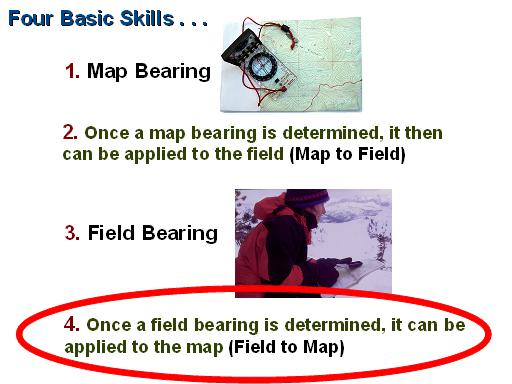
Applying a Field Bearing to the Map
(Field to Map)
By Ron Watters, Professor Emeritus of Outdoor Education, Idaho State University
This is the continuation of a several part series on compass use. If you haven't already, you'll want to start on the introductory page found here: Compass Technique.
(Or, if you'd rather pick from a list of topics, you'll find it here: Topic Index.)
Field to Map (First Situation)
We have covered how to take a field bearing here. In this section, we discuss how to apply a field bearing to a map - or, to keep things short, we'll say "field to map."
Three situations guide how field bearings are applied to maps:
1. We know our location and would like to identify distant points
3. We have no idea where we are (but we can identify at least two distant points)
Let's begin with the first situation:
1. We know our location and would like to identify distant points
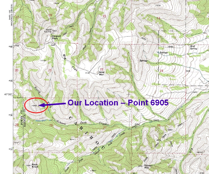
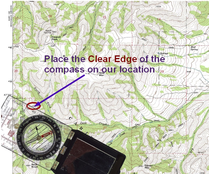
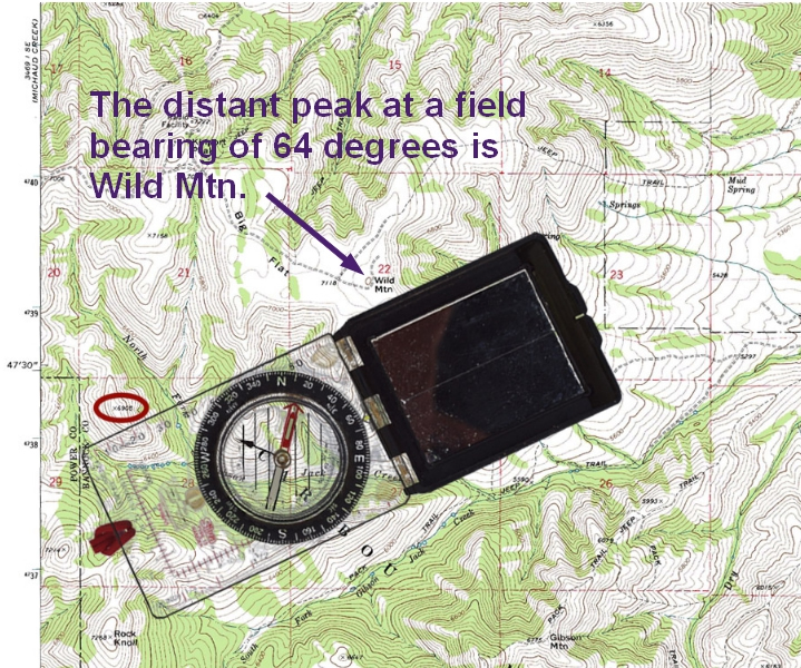
To illustrate how this works, we'll use the following map. In this use of a field bearing, we know our location, so let's say that we are at Point 6905 (below):
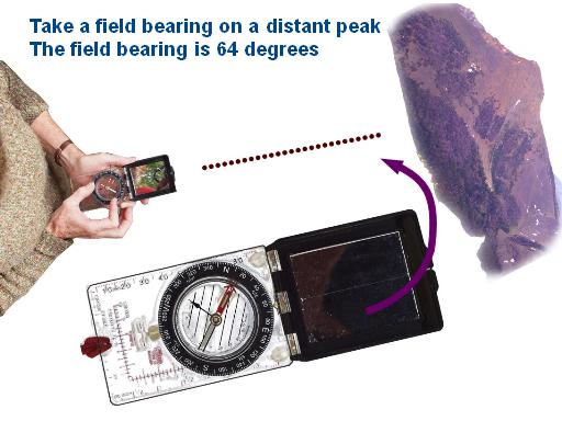
From Point 6905, we take a field bearing on a distant peak that we want to identify. (Instructions on how to take a field bearing is found here.) We find that the field bearing is 64 degrees (below):
Now we apply field bearing to the map. Place the compass on the map so that the clear edge is on Point 6905. (If you don't have a mirrored compass, place the compass so the rear edge is on Point 6905. Not sure what I mean by the rear edge? There's a a diagram on this page.)
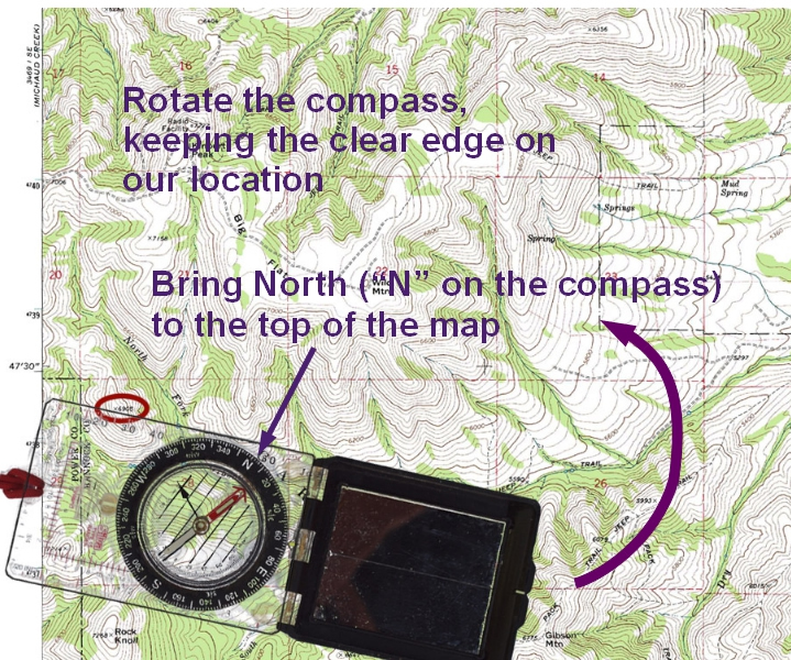
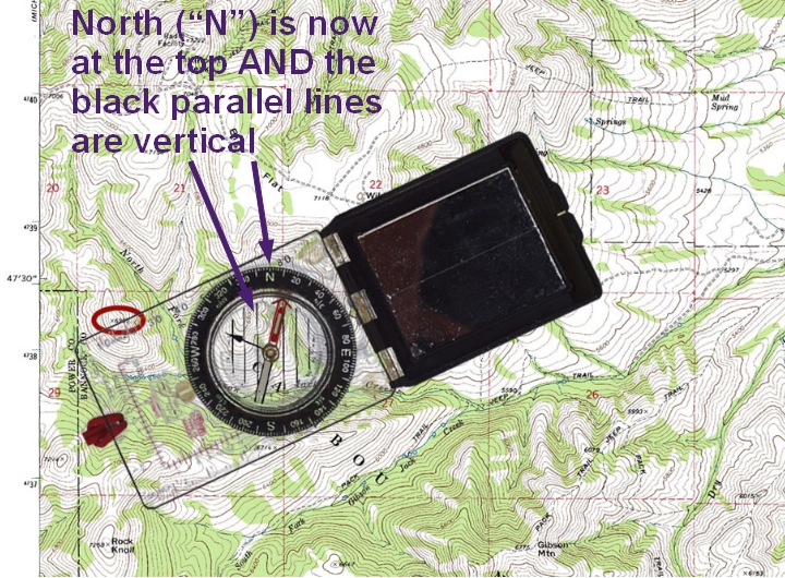
Start rotating the compass, keeping the clear edge (or rear edge) of the compass on Point 6905. You want to rotate the compass so that "N" on the compass dial will end up at the top.
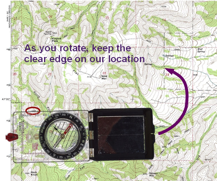
As you rotate, keep the clear edge on Point 6905:
Keep rotating until "N" (North) on the compass is at the top. AND the parallel lines are vertical. The parallel lines aren't quite vertical in the illustration, below, so we keep rotating a bit more:
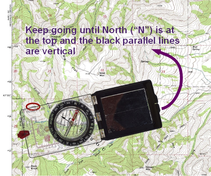
Stop and double check. "N"(North) on the compass should be at the top and the parallel lines should be vertical. Check to make sure that "S" (South) is not at the top of the map. That's a common mistake.
Look along the edge of the compass. We can now identify the peak to which we took the field bearing. The name of the peak is Wild Mtn.
For a bit more information about making sure the parallel lines are vertical, see: Aligning Parallel Lines.
NEXT: To go to second field-to-map situation - where we don't where we are, but we are along a stream, trail or road (and we can identify one distant point) - click here.
(Or, if you'd rather pick from a list of topics, you'll find it here: Topic Index.)
[END]