
Applying a Field Bearing to the Map
Field to Map - 2nd Situation
By Ron Watters, Professor Emeritus of Outdoor Education,
Idaho State University
This is the continuation of a several part series on compass use. If you haven't already, you'll want to start on the introductory page found here: Compass Technique. This page deals with a specific scenario when applying a field bearing to the map.
(Or, if you'd rather pick from a list of topics, you'll find it here: Topic Index.)
Field to Map (2nd Situation)
We have covered the first situation when applying a field bearing to the map, found here. On this page, we'll look at the second situation:
2. We don't where we are, but we are along a stream, trail or road (and we can identify one distant point)
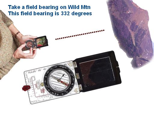
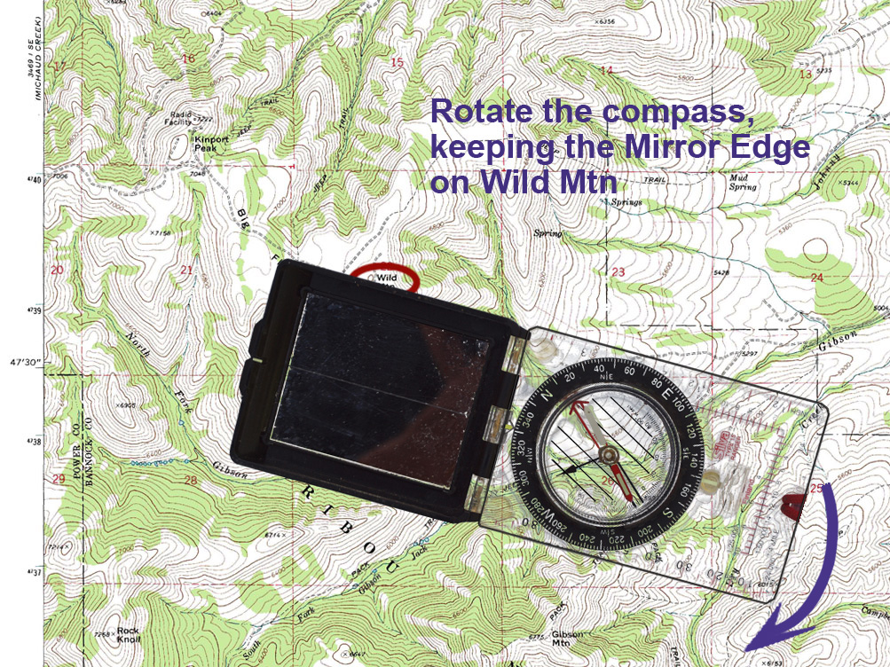
Let's say that we are along Gibson Jack Creek shown on the map below. We are somewhere along the creek but we don't know where. We look up and we can plainly see Wild Mtn. We can use, then, Wild Mtn. to locate ourselves along the creek.
We take a field bearing and we find that Wild Mtn is at 332 degrees.
Place the compass on the map so that the mirror edge is on Wild Mtn, shown below. (If you don't have a mirrored compass, place the compass so the front edge is on Wild Mtn - the front edge is shown on diagram on this page.)
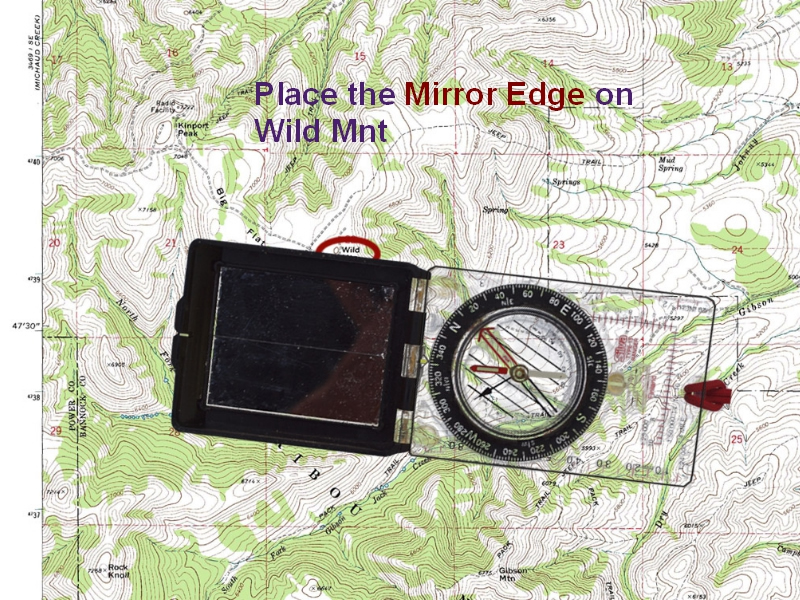
Start rotating the compass, keeping the mirror edge (or front edge) of the compass on Wild Mtn. shown on the map below. (Don't change the bearing. You are rotating the entire compass.) You want to rotate the compass so that "N" on the compass will end up facing the top of the map.
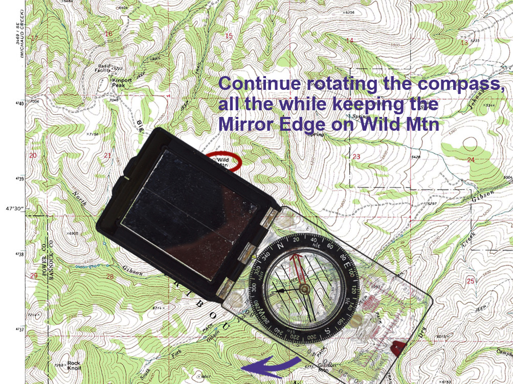
Continue to rotate the compass, making sure the mirror edge remains on Wild Mountain:
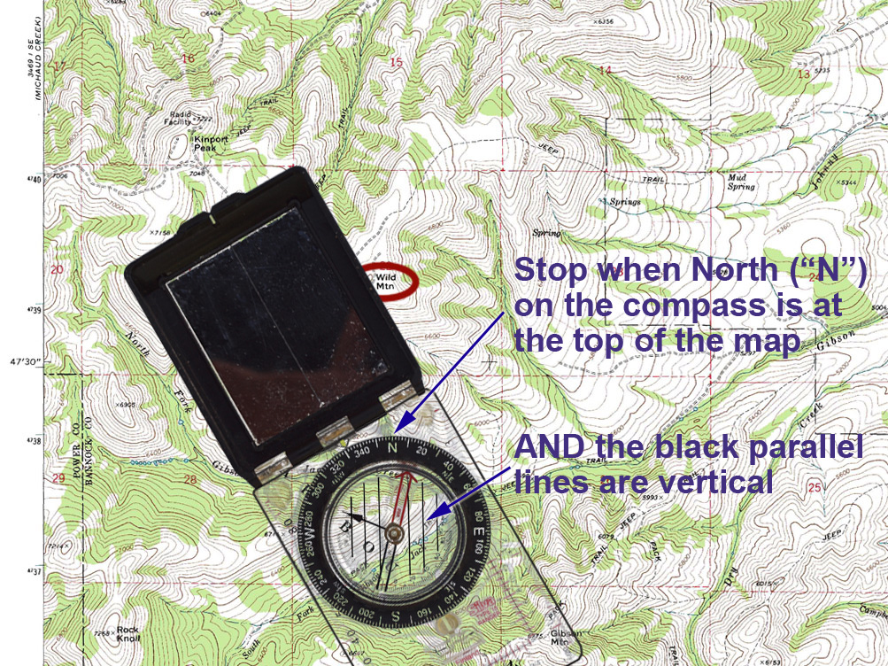
You can stop rotating when North ("N") on the compass is at the top of the map and the parallel lines are vertical - see below. (Double check to make sure that "S" (South) is not at the top of the map. Accidentally rotating the compass so "S" is at the top is a common mistake.)
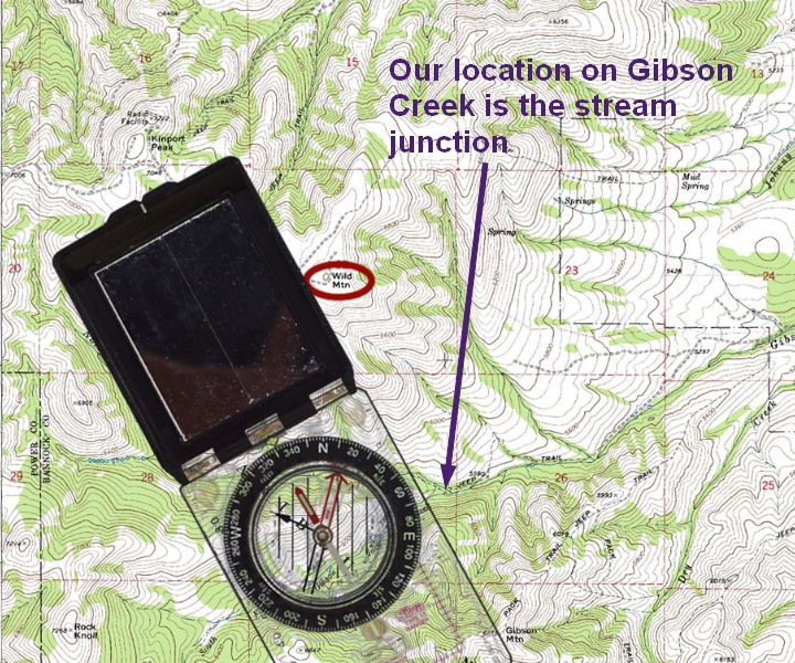
Look along the edge of the compass. Where the edge of the compass crosses Gibson Jack Creek is our location:
For a bit more information about making sure the parallel lines are vertical, see: Aligning Parallel Lines.
NEXT: To go to the third field-to-map situation - where we simply don't where we are, but can identify two distant points) - click here.
(Or, if you'd rather pick from a list of topics, you'll find it here: Topic Index.)
[END]